Point Reyes National Seashore Photos
Return to Point Reyes National Seashore
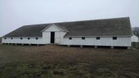
The most impressive structure at the Pierce Point Ranch site was the large dairy barn. The Tomales Point Trail starts just to the left of the barn. (Photo by
Austin Explorer)
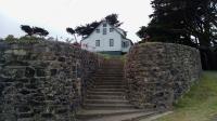
The bronze plaque to the left of the stairs leading to the house commemorates the 1579 visit to the area by Sir Francis Drake. (Photo by
Austin Explorer)
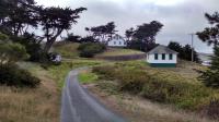
Several of the buildings used for housing and maintenance of the lifeboat station are still in use. (Photo by
Austin Explorer)
The trail's signature feature. A secure place for birds to escape land based predators. (Photo by
Austin Explorer)
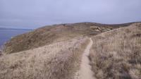
In the distance one can make out a group of people just leaving the end of the trail. (Photo by
Austin Explorer)
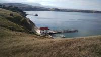
The historic lifeboat station as seen from the trail. The three rail ramp leading to the water allowed for quick response. Support buildings are among the trees farther up shore. (Photo by
Austin Explorer)
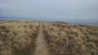
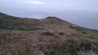
Chimney Rock Trail heading towards the southernmost tip of the point. (Photo by
Austin Explorer)
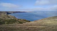
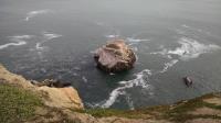
A view of Drake's Bay from the trail leading to Point Reyes National Seashore's Chimney Rock. (Photo by
Austin Explorer)
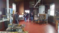
A view of some of the machinery used to keep the lights and fog horns that served as navigation aids in working order. (Photo by
Austin Explorer)
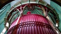
A closeup of the Fresnel lens still housed in the lighthouse. (Photo by
Austin Explorer)
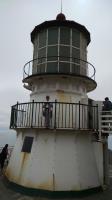
Coppertone poses on the walkway around the tower that houses the Fresnel lens. (Photo by
Austin Explorer)
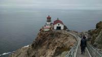
A closer view of the lighthouse and its support buildings. (Photo by
Austin Explorer)
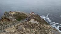
A view of the Point Reyes Lighthouse from near the top of the stairs. Rectangular platforms to the side are for visitors needing rest from their efforts. (Photo by
Austin Explorer)
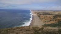
Miles of largely empty beach as seen from the southernmost tip of the Point Reyes National Seashore. (Photo by
Austin Explorer)
A view of the trail leading to the whale watching spot. (Photo by
Austin Explorer)
The actual earthquake induced gap is under the trees to the right. The light blue poles lined up mark the actual location of the San Andreas fault. (Photo by
Austin Explorer)
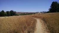
A view along Morgan Trail as it heads back towards the Bear Valley Visitor Center. (Photo by
Austin Explorer)
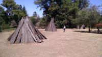
Coppertone walks amongst the kotcas (houses) in the recreated village. (Photo by
Austin Explorer)
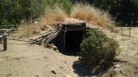
Entrance to the smaller of the two sweat lodges at the village site. (Photo by
Austin Explorer)
 Back
Back