Jasper-Agate Loop

This sign points to where the trail starts/ends.
User:
Blaze
- 8/1/2014
Location:
Jasper-Agate Loop
Rating:

Difficulty:

Solitude:

Miles Hiked: 3.40 Miles
Elapsed Time: 2 hours, 22 minutes
Log Photos
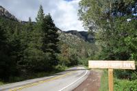
Trailhead
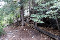
View Of The Trail

Another View Of The Trail

Weather Changes Quickly!