Olompali State Historic Park Photos
Return to Olompali State Historic Park
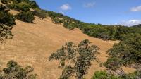
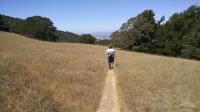
The grasses have already turned almost completely brown. (Photo by
Austin Explorer)
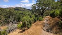
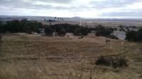
A typical view on the trails at Olompali State Park. (Photo by
Austin Explorer)
A view of the Petaluma River from the Burdell Trail. A bent over California Buckeye can be seen in the foreground. (Photo by
Austin Explorer)
The Miwok Village off of the Miwok Trail shows examples of village structures and the plants they used for food and medicine. (Photo by
Austin Explorer)
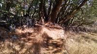
Small segments of grassland opened up on the side trail we took. (Photo by
Austin Explorer)
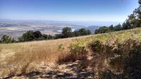
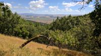
From our resting spot we could easily see into San Pablo Bay and even Mount Diablo in the distance. (Photo by
Austin Explorer)
Several rock walls marked boundaries in the past. The Burdell Trail passes right through one. (Photo by
Austin Explorer)
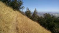
A view of the trail as it hugs the slope of the mountain. (Photo by
Austin Explorer)
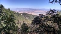
A view from near the top with the Petaluma River flowing to the right and the City of Petaluma on the left. Behind both rises Sonoma Mountain. (Photo by
Austin Explorer)
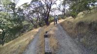
Coppertone on one of the many switchbacks along the trail as it steadily gains altitude. (Photo by
Austin Explorer)
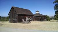
An impressive barn structure that was part of the Burdell Farm. (Photo by
Austin Explorer)
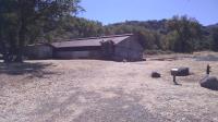
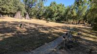
The starting point for the Loop Trail is behind this dairy barn. (Photo by
Austin Explorer)
A view of the buildings remaining of the Burdell Farm. (Photo by
Austin Explorer)